 Language
  Danish
  Swedish
  Belgisk
 Hollandsk
WSUD and a fauna corridor in Bækrenden
One of the first WSUD systems with a fauna corridor in Denmark is located in Bækrenden near Vallensbæk Landsby and was laid out in 2005.
Bækrenden is a branch of the St. Vejleå river system. It receives large rainwater volumes from Vallensbæk Nordmark, Holbæk motorway and the surroundings of Brøndby.
Bækrenden has limited capacity and heavy inlet flows can cause flooding in Vallensbæk Landsby. This occurred frequently before the WSUD system was implemented.
The municipality's consultant at the time carried out model calculations showing that if the inlet into the village's pond exceeded roughly 800 l/s, the village would experience flooding.
Upstream from the village is a field/meadow whose areas near the stream bank can withstand flooding.

In 2005, a fauna-passable Mosbaek double baffle with in-built emergency overflow was installed at the meadow to limit the inlet into the village to a maximum of 800 l/s.
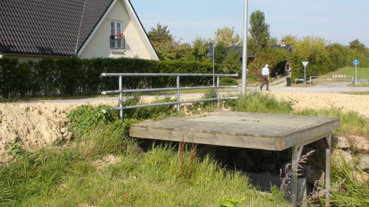
The flow regulator is installed at the inlet to the road bridge on Højrupgårdsvej.
The flow regulator was dimensioned for discharge of up to 2 m3/s. At the time, this was an 18-year event.
If the inlet to the flow regulator exceeds 800 l/s, this increases the resistance in the flow regulator, and the water level rises correspondingly upstream from the flow regulator, which causes flooding of the stream bank.
When the volume available on the stream bank is used up, the water level will be so high that it will flow into the flow regulator's built-in emergency overflow (at level 3.03).
Since 2005, various ground levelling measures have been implemented around the flow regulator, but the current terrain (late 2015) has a retention volume of roughly 1100 m 3 up to level 3.03.
The flow regulator is dimensioned so that when the flow is at 2 m3/s, the water will be roughly 25 cm below the road's level, which is approximately 3.50.
The municipality is continuously implementing new WSUD initiatives in the area. This is exemplified by Addendum 1 to the Municipal Development Plan, Climate Adaptations 2013-2015, which states that Bækrenden's capacity must be increased and that the attenuation of rainwater upstream from the Vallensbæk village pond must be increased. Additional initiatives aim to increase the basin capacity, etc., of the Nordmark area from roughly 14,000 m3 to roughly 34,000 m3. Please refer to Vallensbæk Municipality's waste water management plan and addenda, as well as the municipality's website for further details about future initiatives.